Our initial goal heading home from California was to drive along Highway 1 -- Pacific Coast Highway. We knew it would take several days, so allowed ourselves some leisure time before heading north. We stopped in again at the Santa Monica Pier. Saw some morning fishermen pull in a halibut. After a stroll on the beach, we packed up the motorcycle and headed out.
 |
Looking at our previous day's
route through Beverly Hills |
 |
| Santa Monica Pier |
 |
| Entrance to Highway 1 |
 |
| Views from Highway 1 |
 |
Look closely & you can see
the windsurfers |
 |
| Spectacular views of the ocean |
We stayed in Ventura, and after checking weather.com, we learned that there was a high wind warning along the coastline. We took one final look at the ocean, and then headed inland towards Bakersfield. We entered the hills of California at Ojai. We saw some beautiful country along the way. Once out of the hills we saw ranch and farming areas, including rice, pistacios and wine (among which were scattered oil rigs). We had lunch in Bakersfield, and after looking at the map, we continued on to Visalia. Our friends had blogged about their adventure in Sequoia National Park, so we thought we would give it a visit.
 |
| Farewell to the Pacific |
 |
| Ojai Foothills |
 |
| - |
 |
| - |
 |
| Pistacio Trees |
 |
| Rice |
 |
| Sharing the fields |
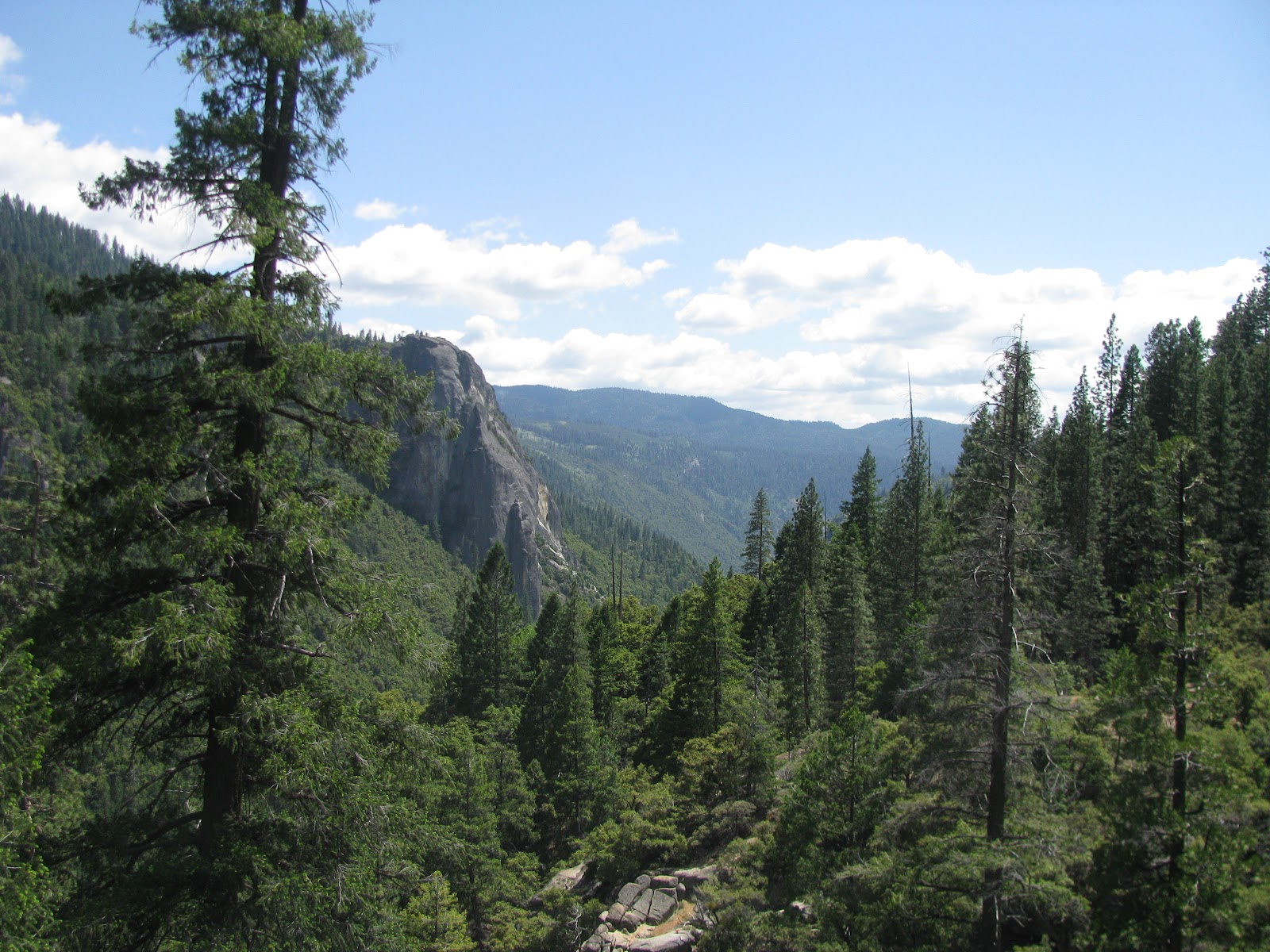
The next few days were devoted to National Parks. Because of the snow in Yosemite, we had to delay our trip one day -- so took advantage by visiting Sequoia and Kings Canyon National Parks. I'll let the photos speak for themselves. We met other motorcyclists throughout the park. The one at the gate were from Florida. He had driven the motorcycle west and she joined him in Las Vegas.
 |
| Sequoia National Park |
 |
| Entrance - Florida couple |
 |
Tunnel Rock -- Road used to
pass under the rock |
 |
| Sequoia Grove |
 |
| - |
 |
| Below General Sherman |
 |
| General Sherman Description |
 |
| General Sherman |
 |
| Cross-Section |
 |
| Cross-Section Description |
 |
| General Sherman |
 |
| - |
 |
| World's Largest Sequoia Grove |
 |
| King's Canyon National Park |
 |
| More Sequoias |
 |
| Canyon |
 |
| Confluence |
 |
| Road Continues into the canyon |
 |
| Canyon Walls |
 |
| - |
From Visalia we continued on to Fresno where we spent the night. We took a quick drive around the city (seeing Fresno State campus). While we were at the motel, about 12 motorcycles drove in. After talking with them, we found out that they were from Germany and members of a German Goldwing Club. They had brought their motorcycle gear with them to Las Vegas and had rented motorcycles to tour the National Parks and visit San Francisco. Because of the snow the night before, the road was closed and they had to detour south and miss the park.
 |
| Fresno State Stadium |
 |
| German Visitors |
 |
| German Visitors |
The next day our adventure was through Yosemite National Park. It had snowed the night before, so we joked that "we were being snowballed by the trees" when the ice began to melt from the trees. Again, I'll let the pictures speak for themselves.
 |
| Yosemite National Park |
 |
| Snow from night before |
 |
| - |
 |
| - |
 |
| - |
 |
| Yosemite Falls |
 |
| Yosemite Valley |
 |
| Yosemite Falls |
 |
Ed was surprised to see a closed
bathroom on one of the busiest weekends |
.jpg) |
| Bears were known to be in the area |
 |
| Bridal Veil Falls |
 |
| - |
 |
| Picnic below Bridal Veil Falls |
 |
| Bridal Veil Falls |
 |
| - |
 |
-
|
 |
| - |
 |
| - |
 |
| - |
 |
| - |
 |
East Entrance is located at Tioga Pass
Summit -- 9,945 feet |
 |
| East side of Tioga Pass |
We stayed in Lee Vining that night. The town of Lee Vining was founded by a cattle baron. Further into the hills were the gold mining towns. We traveled through more specular country (who would think of California having such beautiful mountains). One area was called the Carson Iceberg Wilderness. We stopped for lunch in Markleeville (another historic town) before arriving in South Lake Tahoe. The border between California and Nevada was the street running alongside of Harrah's and Harvey's Casinos. We had reservations for the night at Harvey's. We opted for a lake view and were not disappointed. We had decided to celebrate my birthday here. Instead of going to one of the restaurants, we chose to have pizza in the room and watch the sunset over the lake.
 |
| Carson Iceberg Wilderness |
 |
| Lunch in Markleeville |
 |
| South Lake Tahoe |
 |
Border between California
and Nevada |
 |
| View of Lake Tahoe from our room |
 |
| Can always find a Hard Rock! |
 |
| Evening view from room |
Since we had to change our original schedule, we were unable to explore this area as planned. We had originally planned to see Donner Pass, Reno, and Virginia City -- now we have an excuse to come back. We packed up and headed out to Carson City.
 |
| One final look at Lake Tahoe |
 |
| Time to reload! |

As we were leaving Stateline we saw this sign. We looked for the crosswalk; but, since they were doing constrution in the area, the bears must have had the day off.

From Carson City we headed east on US Highway 50. This route was originally selected because it would get us to Steamboat the quickest for Eric's (Ed's grandson) graduation. As we traveled the many miles of straight, two-lane highway, we learned more about the highway. Several years ago it was named "The lonliest road in USA" by Life Magazine. Distances between towns varied from 70 to 115 miles -- with no other civilization in-between.

After being given the name by Life Magazine, the townships along the way decided to promote the title in a positive way. They worked with the Nevada Dept of Tourism and now have a "Survival Kit" that travelers can complete and receive a certificate at the end of their journey. They have designed a booklet, like a passport, that travelers need to get stamped at the various locations. The booklet also gives the traveler an outline of the history and attractions in the towns and areas along the route. When the journey is complete, the stamped pages are mailed back to Nevada Tourism, and the traveler receives a certificate of completion.
We learned about the kit in Eureka, about half way, from a fellow motorcyclist who was traveling the entire US50 from Maryland to Sacramento. Another motorcyclist we met along the route was a gal from Hawaii who had shipped her motorcycle to the states so she could attend a motorcycle rally in Moah, UT. She was camping and had a lot more gear than we did.
 |
| Pony Express Anniversary |
 |
Pony Express Station
|
Route 50 is also known as the Pony Express Trail. Various reminders of mail stops and Overland Stagecoach sites can be seen along the highway.
Towns along the route had various backgrounds. Fallon is home to a Naval Air Training Base. Austin was one of the most prosperous mining camps. We stopped at the 'International' for lunch. This building had been moved from Virginia City piece-by-piece thinking that the cafe, bar, and 'hotel' would receive more business during the mining days. Eureka was also a silver mining camp. If traveling this way -- be sure to make hotel reservations -- there was only one motel in town. Although Ely also had mining, it also became a railroad community. Everyone in each of the town's were extremely friendly, and ready to swap stories.
 |
| Fallon |
 |
| International - 1863 - Austin |
Throughout the trip there was not a lot of wildlife -- we did see this one along Highway 50.
We entered Utah on Highway 50. It was after we spent the night in Delta that we started seeing the green agricultural fields again. We took a short jaunt on I-15 to reach Provo (taking us past BYU Stadium). Outside of Provo, we saw Utah's version of Bridal Veil Falls. Took a quick trip to see Sundance Ski Area (no sighting of Robert Redford) and then on to Vernal.
Before reaching Steamboat, we stopped at the Dinosaur National Monument. In 1998, Ed and I had taken our first motorcycle ride to Yellowstone and came back via Vernal. We tried to see the monument then, but got there at closing time. We were always going to try and return. It is definitely a plus to see. The park is located in both Utah and Colorado and covers over 210,000 acres. Although we only had time to stop at the quarry (where they have the dinosaur fossils), there is also river rafting, scenic drives, hiking trails, and petroglyphs that can be explored. The Quarry Exhibit Hall houses a wall that has approximately 1,500 dinosaur bones.
 |
| Entrance |
 |
| Quarry Building |
 |
| Quarry Wall |
 |
| Quarry Exhibit |
We arrived in plenty of time to celebrate Eric's graduation with his family before heading back to Fort Collins for Kylee's (my granddaughter) birthday party.
We feel this trip was quite productive. Ed and I have now covered on motorcycle all but 2 states (Oregon and Hawaii) west of the Mississippi. We have completed Route 66. We survived Nevada's Route 50. And, I finally got to see Dinosaur National Monument.
Until next time.


.jpg)


 From Carson City we headed east on US Highway 50. This route was originally selected because it would get us to Steamboat the quickest for Eric's (Ed's grandson) graduation. As we traveled the many miles of straight, two-lane highway, we learned more about the highway. Several years ago it was named "The lonliest road in USA" by Life Magazine. Distances between towns varied from 70 to 115 miles -- with no other civilization in-between.
  After being given the name by Life Magazine, the townships along the way decided to promote the title in a positive way. They worked with the Nevada Dept of Tourism and now have a "Survival Kit" that travelers can complete and receive a certificate at the end of their journey. They have designed a booklet, like a passport, that travelers need to get stamped at the various locations. The booklet also gives the traveler an outline of the history and attractions in the towns and areas along the route. When the journey is complete, the stamped pages are mailed back to Nevada Tourism, and the traveler receives a certificate of completion.


